Julia Pfeiffer Burns State Park
The Park is currently OPEN.
Please check the hours of operation.Expect delays when driving to Big Sur from Monterey/Carmel due to work at the Rocky Creek Slip out area. There is a one lane section of highway here, with daytime flaggers and a 24/7 traffic light.
Beginning April 16th, 2025- THERE WILL BE NO ACCESS to McWay Falls trail due to repairs of an extensive retaining wall. This may also impact available parking spaces inside the park. Work is expected to continue into 2026.
NOTE: Highway 1 is CLOSED to all traffic including vehicles, pedestrians and cyclists 5 miles south of Julia Pfeiffer Burns due to the landslide "Regents Slide." Please see the Highway 1 closure info and maps on our websites. There is currently no anticipated date for the full opening of Highway 1 at Regent's Slide.
Highway 1 remains closed between Esalen Institute and Lucia.
Visitors can now access Limekiln State Park for Day Use from the Cambria/San Simeon area. Limekiln State park is open for limited day use. Please visit the website link on the right side of our page for more information.
Camping reservations can be made at www.reservecalifornia.com up to 6 months in advance.
Always check area weather forecasts and road updates before visiting. NOAA Weather- Big Sur
For more information about USFS properties and current closures, please visit USFS - Los Padres National Forest - Big Sur
For current highway closures and conditions please visit CalTrans - Road Conditions Map
Follow us on social media @BigSurStateParks for photos and information.
HIGHWAY 1 CLOSURES
Northbound / Southbound 1 Full Closure

From Turnout South of Vicente Creek to Turnout South of Lime Creek
Due to Emergency Work
No estimated time for reopening of closure.
Information courtesy of
Last updated: 01/07/2025 4:35pm
About Julia Pfeiffer Burns State Park
* * * CLOSED AREAS ***
THERE IS NO BEACH OR OCEAN ACCESS at McWAY FALLS
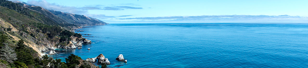
This state park is named after Julia Pfeiffer Burns, a well-respected pioneer woman in the Big Sur country. The park stretches from the Big Sur coastline into nearby 3,000-foot ridges. It features redwood, tan oak, madrone, chaparral, and an 80-foot waterfall that drops from granite cliffs into the ocean waters of Monterey Bay National Marine Sanctuary. The higher elevation trails east of Highway 1 (currently closed) offer panoramic views of the sanctuary and miles of rugged coastline.
Weather CHECK CURRENT WEATHER
The weather can be changeable. Layered clothing is advised. In winter, overnight temperatures can range in the 30s-50s (Fahrenheit). Winter daytime temperatures can be low 50s-70s. In summer, overnight temperatures can range in the 50s-70s, with daytime temperatures typically in the 70s-80s. Summer mornings bring fog, which usually burns off by midday.
Location
Near mile marker 35.8 on Highway 1, the park is 37 miles south of Carmel. GOOGLE MAP
OVERNIGHT HIGHWAY 1 CLOSURES
EXPECT ROAD WORK DELAYS AT ROCKY CREEK SLIP OUT, 13 MILES SOUTH OF CARMEL.
Whale Watch for February 15th will continue as scheduled from 10 a.m.-12 p.m. at the vista point 10 miles south of the Big Sur Station. google map location here.