Open and Public GIS Data
California State Parks generates eight GIS datasets intended for free distribution and personal or public use. These datasets include: Park Boundaries, Routes, Buildings, Structures, Day Use Areas, Camping Areas, Parking Areas, and Park Entry Points.Please review the data license before downloading and using our data.
Maps & Apps
Park Explorer Map
The Park Explorer Map is an interactive web map that allows you to explore details for each park in the California State Park System. The map uses the standard parks symbology found in our Brochures and Park Infosheets showing: roads, trails, buildings, structures, campsites, day use areas, and more. The map is updated frequently as new data is added and refined.

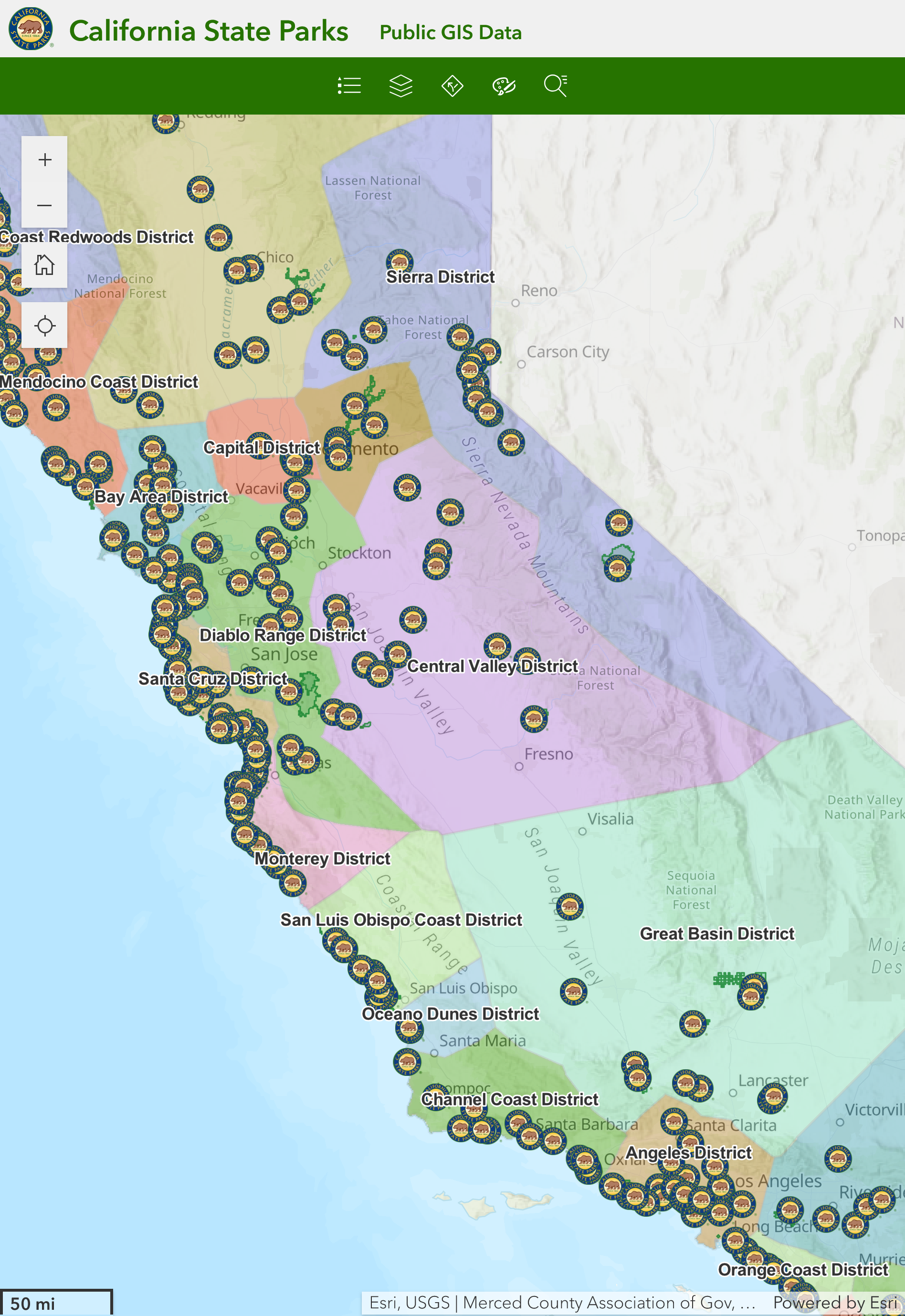
Open Data Web Map
This interactive web map is provided by California State Parks Statewide Geospatial Information Services Program, and is intended for planning and general reference. It displays California State Parks' Open/Public Data including: Park Boundaries, Routes, Buildings, Structures, Day Use Areas, Camping Areas, Parking Areas, and Park Entry Points.
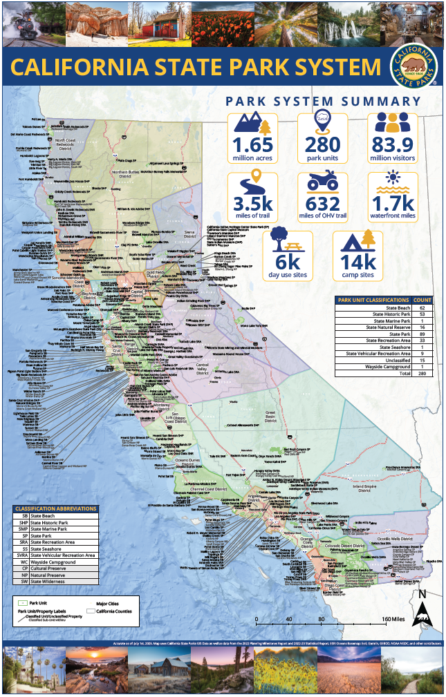
California State Park System Map
This large format map, which is updated annually, shows all units of the California State Parks System as well as department district boundaries, highways, and county boundaries. Each park boundary is listed and labeled, showing unit name and identifying subunits (Wildernesses and Preserves). A "Park System Summary" includes system acreage, units, visitors, campsites, and day-use areas counts, as well as trails, OHV routes, and waterfront mileages.