Welcome to Mount Tamalpais State Park
Just makin up poems in my head as I climb toward Mount Tamalpais.
See up there, as beautiful a mountain as you’ll see anywhere in the world,
a beautiful shape to it, I really love Tamalpais.
– The Dharma Bums, by Jack Kerouac
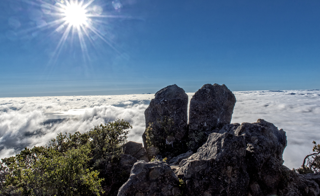
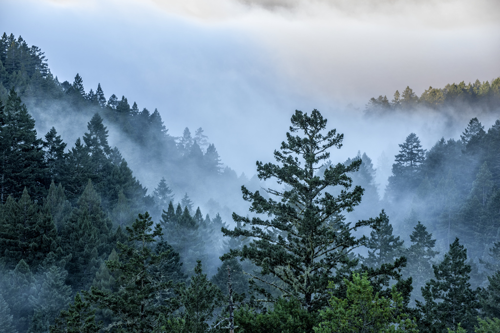
Just north of San Francisco’s Golden Gate Bridge, Mount Tamalpais State Park rises majestically from the heart of Marin County. Its deep canyons and sweeping hillsides are cloaked with cool redwood forests, oak woodlands, open grasslands, and sturdy chaparral.
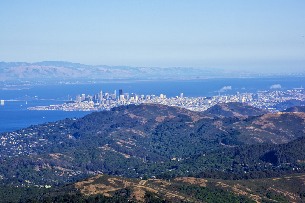
The breathtaking vistas from Mount Tamalpais’s upper mountain include the Farallon Islands 25 miles out to sea, the Marin County hills, San Francisco Bay and City, the East Bay, and Mount Diablo. On rare occasions, the snow-covered Sierra Nevada Mountain Range can be seen 150 miles away.
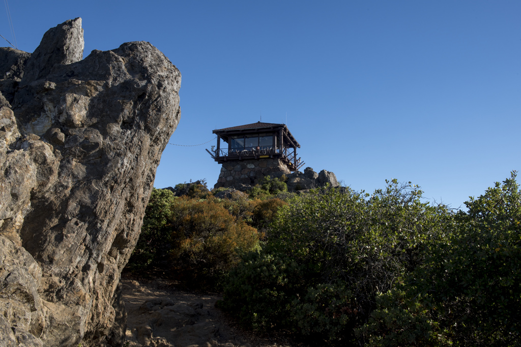
The park offers superlative hiking, picnicking, wildlife watching. Up top, on most weekends volunteers at the East Peak Visitor Center provide information, sell merchandise and snacks. Volunteers at the nearby Gravity Car Barn relate the stories of the old Mount Tamalpais Scenic Railway. A couple of miles below, a beautiful outdoor theatre, the Mountain Theater, hosts outdoor plays and astronomy programs.
First-come/first-serve camping is available at Pantoll or Bootjack Campgrouds. Visitors can also reserve a group campsite at Alice Eastwood Group Camp or a rustic cabin or seaside campsite at the Steep Ravine Cabins and Environmental Campground through our agency Reserve California.
Arrive early to avoid heavy weekend and holiday traffic. Better yet, take the West Marin Stage Coach.
Weather
Spring and summer temperatures are warm, with average highs in the 80s and 90s. Fall and winter can be cool, with temperatures in the 50s. Fog is common.
Important Rules
DRONES are prohibited at Mount Tamalpais State Park per Superintendent's Order 22-660-002.
Mushroom collecting is not allowed at Mount Tamalpais State Park. All natural and cultural park resources (rocks, flowers, wood, animals) are protected by law and must not be disturbed or removed.
Dogs (except for service animals) are ONLY allowed on paved roads, Old Stage Fire Rd, Verna Dunshee Trail, in developed areas, campgrounds, and picnic areas. Pets must remain on leash at all times.
Bicycles are allowed only on fire roads and Coast View Trail.
Be alert for: poison oak, rattlesnakes, mountain lions, and ticks.
Smoking, camping and fires are never permitted in the upper mountain. If not under red flag alert, fires are permitted on the lower mountain only in provided firepits.
Horses are allowed only on fire roads and where specifically posted.
Camping in vehicles is PROHIBITED in all parking lots.
Accessibility
Some of the park’s wheelchair-accessible features include:
- The accessible 0.75-mile-long Verna Dunshee Trail at East Peak has fantastic views. Accessible tables, restrooms and drinking fountains are nearby. :
- Spectacular vistas may also be seen from an accessible 0.4-mile portion of the Old Mine Trail from Pantoll Station.
- Pantoll and Bootjack campgrounds each have accessible camping, restrooms and parking.
- Cabin #1 and environmental campsite #7 at Steep Ravine are accessible.
- The Mountain Theater has a wheelchair platform on the right side of the theater. The Mountain Play Association offers signed performances and descriptive services during the first three play performances each season. For more information, call the Mountain Play Association at 415-383-1100.
Visitors with disabilities who need assistance can contact the Pantoll Visitor Services Kiosk at 415-388-2070 before their trip.
Special Event Permits
For weddings, athletic events, film and photography permits, please contact: Peter.Ostroskie@Parks.ca.gov
Trail Updates
From April 1st through late May, there will be trail work on Coast View Trail, including on some weekends. The trail will remain open during the work. However, due to the use of heavy equipment, trail guards will be posted to caution or hold trail users as needed. Please follow the directions of park staff during maintenance work and pardon our dust.
If you have questions regarding trail closures, please contact the Pantoll Kiosk at (415) 388-2070.
MUIR WOODS NATIONAL MONUMENT
Many trails in Mount Tamalpais State Park connect with trails in the neighboring Muir Woods National Monument. Please check their alerts page for information on any trail work or trail closures there.