California State Parks Bay Area District Enhances Wildfire Resilience Ahead of Fire Season
July 3rd, 2025
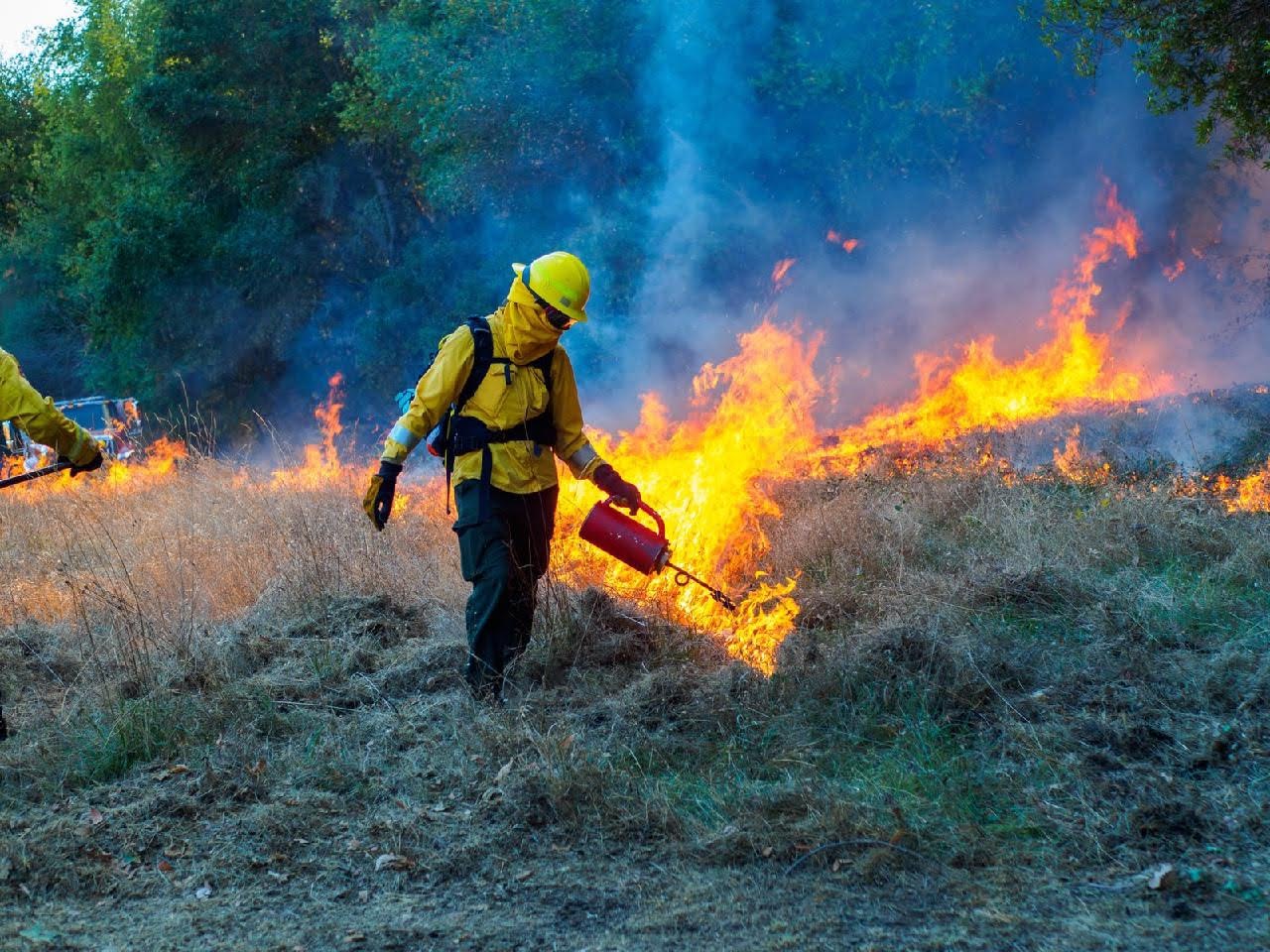
Petaluma, Calif. – California State Parks, in cooperation with a variety of partners, has completed a series of wildfire resilience projects across multiple parks in the Bay Area District ahead of the 2025 fire season. These efforts have included defensible space work, fuel reduction, prescribed burning, air-curtain burning, invasive tree removal, and other aligned treatments across 14 State Parks in Marin, Napa, and Sonoma counties.
Highlights from the past eight months include:
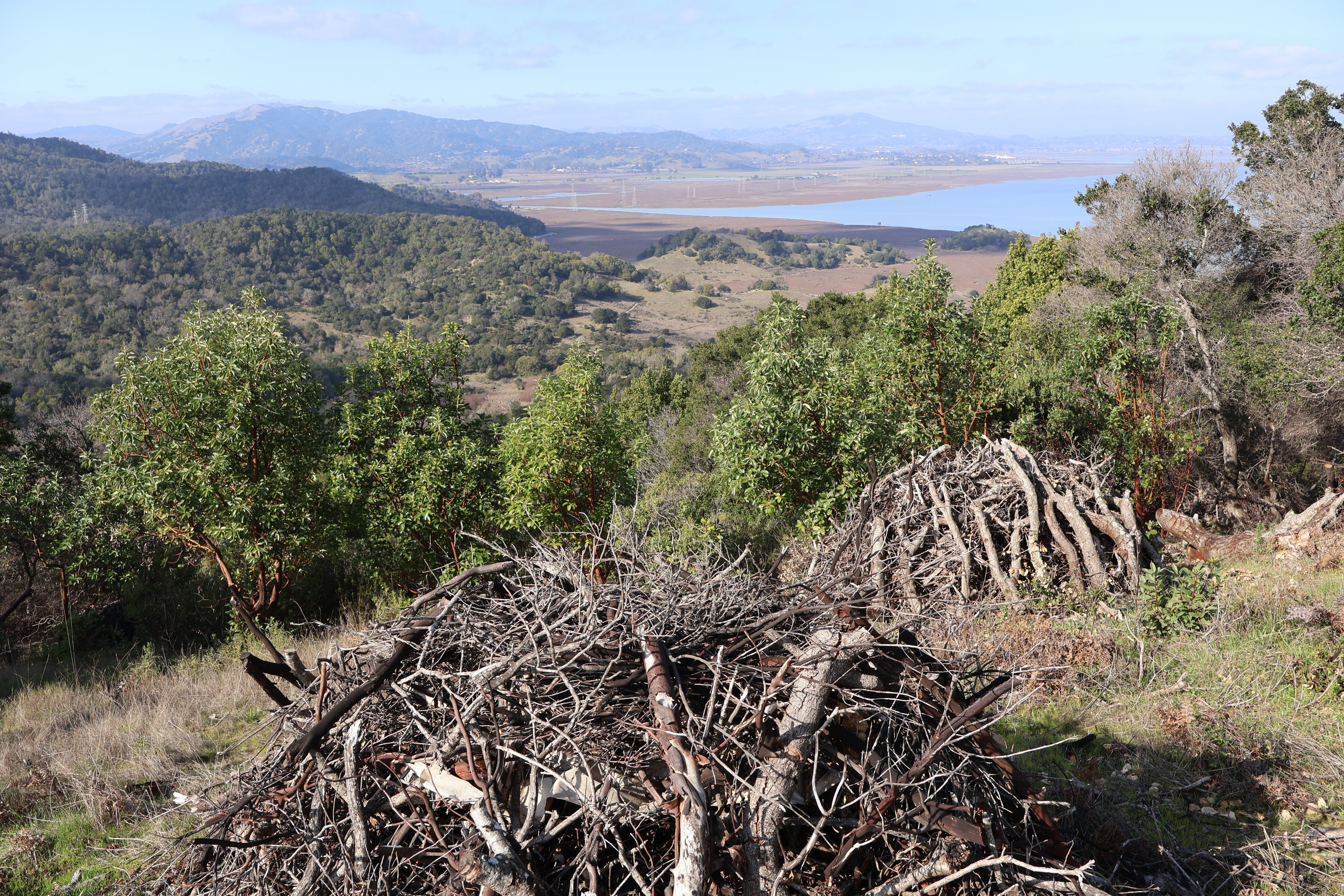
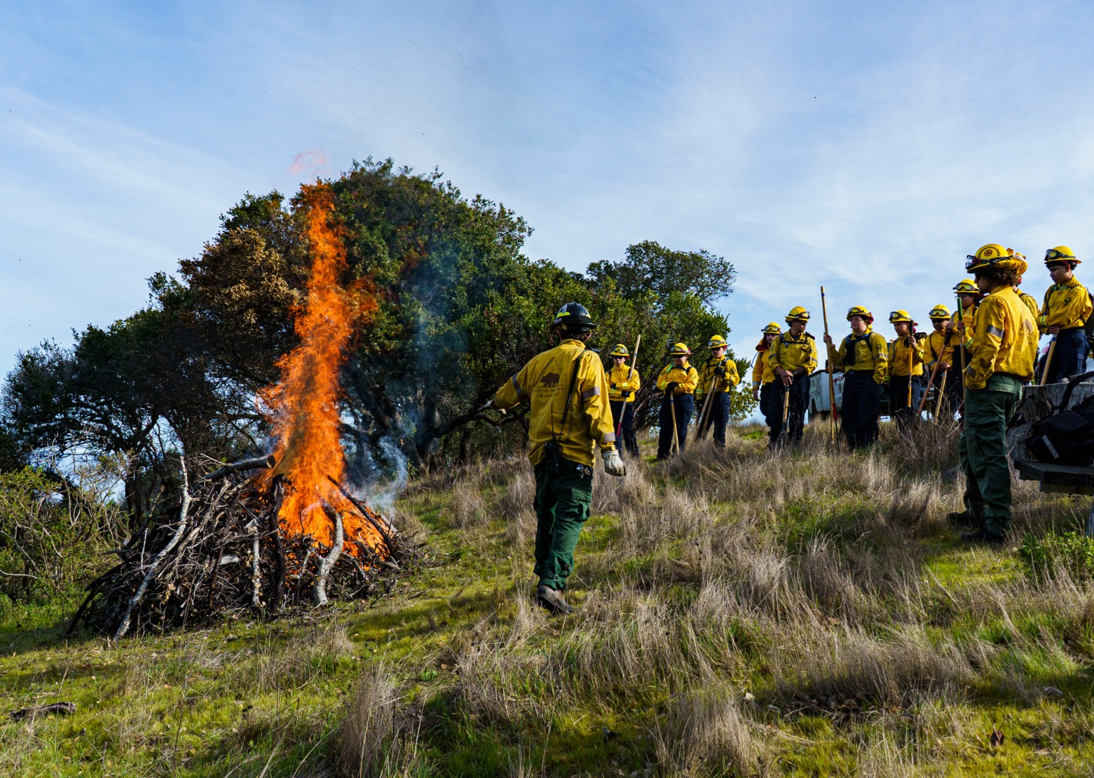
- Construction and burning of 2,320 piles of dead wood across 80+ acres in 9 parks
- Expanded defensible space work around dozens of park structures in 5 parks
- Strategic removal of invasive trees, brush, and dead wood from 125+ acres in 11 parks
- Increased maintenance and brushing along 10+ miles of strategic fire roads.
- Increased public outreach about ongoing projects, fire ecology, and science.
- Development and delivery of educational programs for park visitors about fire.
"Our State Parks are irreplaceable treasures, and this wildfire resilience work, emphasizes our deep commitment to protecting them," stated Maria Mowrey, District Superintendent of California State Parks, Bay Area District. "From strategic fuel reduction and prescribed burns to educational outreach, these efforts not only enhance habitat, but also build a more resilient future for our parks and surrounding communities”
Work on these projects was carried out by State Park staff and contractors, in partnership with crews from the California Conservation Corps, CAL FIRE, the Marin County Fire Department and it’s Fire Foundry Program. Funding for these projects comes from California State Parks' Facility Ignition Prevention Program, Wildfire and Forest Resilience Program, and grants to One Tam and the Sonoma Valley Wildlands Collaboratives.
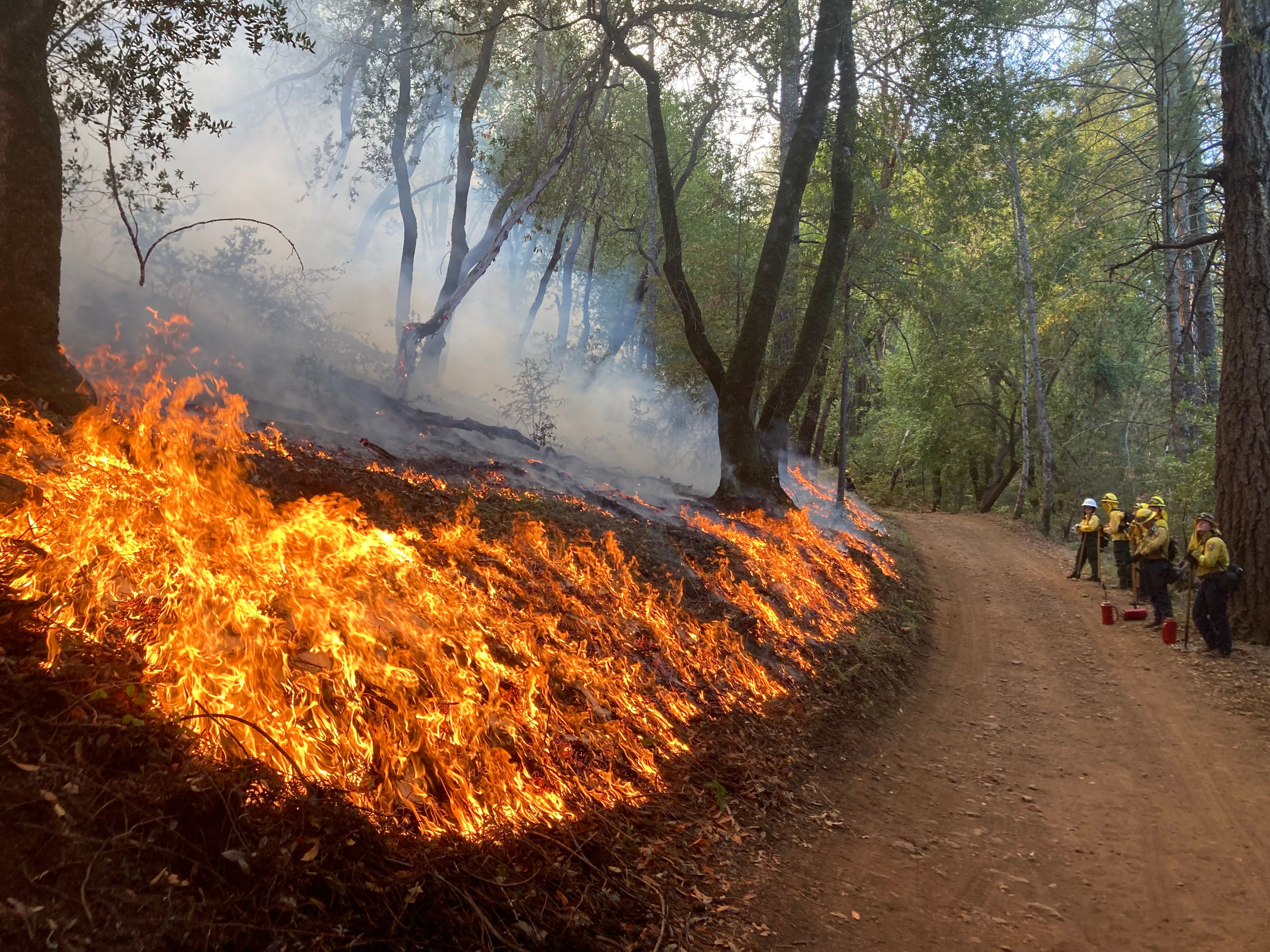
Included in this were a number of prescribed broadcast burns conducted in late fall 2024 and spring 2025 totaling 42 acres at Mount Tamalpais State Park, Sugarloaf Ridge State Park, and Jack London State Historic Park. These burns aimed to enhance habitat, preserve biodiversity in grassland ecosystems, and reduce fuel loads along key access roads, critical for emergency response.
“The safety of our visitors and health of our ecosystems are critical” said Matthew Allen, Deputy District Superintendent of California State Parks, Bay Area District. “This is why it is so important for us to take a proactive role in strengthening our parks and communities against the threat of wildfires. We are so thankful for the continued support of our fire agency partners who help make this work happen.”
This work builds upon annual maintenance activities around park structures, visitor use areas, and roadways—making both the parks and the habitats they protect more resilient to future wildfires. Please do your part to help protect your local state parks from wildfire by recreating responsibly, following park rules and regulations. To learn more about how you can do your part to prepare for wildfire season, visit readyforwildfire.org.
Contact:
Peter Ostroskie, Public Information Officer | California State Parks Bay Area District
(916) 906-2257
Ryan Forbes, Public Information Officer|California State Parks Bay Area District
(415) 827-3064
Prescribed fire operations to begin at Sugarloaf Ridge State Park
California State Parks in cooperation with CAL FIRE Sonoma-Lake-Napa Unit is planning a 14-acre prescribed burn in Sugarloaf Ridge State Park, as soon as Monday June 16, 2025 or when conditions permit. The effort may be carried out in cooperation with local fire agencies and with support from members of the Sonoma Valley Wildlands Collaborative and Team Sugarloaf.
This work is part of the park’s prescribed fire program and is being conducted to support ongoing vegetation management, invasive plant control, wildlife habitat improvement and other long term stewardship efforts. This prescribed burn is specifically aimed at reducing fuel loading along a strategic road ahead of wildfire season and enhancing grassland habitat in the park by reducing populations of invasive yellow star thistle (Centaurea solstitialis) and Medusa head grass (Elymus caput-medusae).
Prescribed burns are coordinated with the Bay Area Air Quality Management District in order to minimize the smoke impacts on surrounding communities. All burning depends on weather and air quality conditions that are favorable for smoke dispersal. If the conditions are not conducive for safe burning, the burn will be rescheduled.
A few trails near the burn area, including portions the Meadow and Hillside Trails, will be temporarily closed for 1-4 hours while the burn is conducted. Please adhere to posted closure signage and any directions from park staff or CAL FIRE personnel for your safety. People traveling near the burn areas may see smoke from 9 a.m. to 6 p.m. on burn days, with minimal smoke produced for up to 2 days following ignitions. In the unlikely event you smell smoke, officials urge you to take precautions and use common sense to reduce any harmful health effects by limiting time spent in smokey area.
Prescribed Burn at Jack London State Historic Park
Glen Ellen, Calif. - California State Parks in cooperation with CAL FIRE Sonoma-Lake-Napa Unit is planning a 6.5-acre prescribed burn in Jack London State Historic Park, as soon as Monday June 2, 2025 or when conditions permit. The effort may be carried out in cooperation with local fire agencies and with support from members of the Sonoma Valley Wildlands Collaborative and Jack London Park Partners.
This work is part of the park’s prescribed fire program and is being conducted to support ongoing vegetation management, invasive plant control, wildlife habitat improvement and other long term stewardship efforts. This prescribed burn is specifically aimed at reducing fuel loading along a strategic road ahead of wildfire season and enhancing grassland habitat in the park by reducing populations of invasive Barb goatgrass (Aegilops triuncialis) and Medusa head grass (Elymus caput-medusae).
Prescribed burns are coordinated with the Bay Area Air Quality Management District in order to minimize the smoke impacts on surrounding communities. All burning depends on weather and air quality conditions that are favorable for smoke dispersal. If the conditions are not conducive for safe burning, the burn will be rescheduled.
A few trails near the burn area, including portions the Mountain Fire Road and the Old Fallen bridge Trail, will be temporarily closed for 1-4 hours while the burn is conducted. Please adhere to posted closure signage and any directions from park staff or CAL FIRE personnel for your safety. People traveling near the burn areas may see smoke from 9 a.m. to 6 p.m. on burn days, with minimal smoke produced for up to 1 day following ignitions. In the unlikely event you smell smoke, officials urge you to take precautions and use common sense to reduce any harmful health effects by limiting time spent in smokey area.
Please use extreme caution while recreating near prescribed fire operations due to fire personnel and equipment in the area.
Contact:
Peter Ostroskie, Public Information Officer | California State Parks
(916) 906-2257
Jason Clay, Public Information Officer | CAL FIRESonoma-Lake-Napa Unit
707-480-1141

Pile Burning Operations to Begin at China Camp State Park
January 21, 2025
Contact: Peter Ostroskie, Public Information Officer
California Department of Parks and Recreation
Peter.Ostroskie@parks.ca.gov | 916-906-2257
MARIN COUNTY, Calif. - California State Parks, in cooperation with local fire agencies, plan to conduct a series of intermittent pile burns at China Camp State Park, as soon as Wednesday January 22, 2025, or soon after when conditions permit.
This work is part of California State Park’s prescribed fire program. It is being conducted to support ongoing vegetation management, fuel reduction, wildlife habitat improvement, and other long-term stewardship efforts. These pile burns are specifically aimed at reducing dead and down woody material along roads and trails in the footprint of past prescribed understory burns along the McNears Service Road and Oak Ridge Trail.
Pile burning is only conducted on days approved by the Bay Area Air Quality Management District to minimize smoke impacts to surrounding communities. All burning depends on weather and air quality conditions that are favorable for smoke dispersal. If conditions are not conducive for safe burning, the burns will be rescheduled.
A few trails near the pile burn areas, including portions of the McNears Service Road and Oak Ridge Trail, may be temporarily closed for a few hours while piles are being ignited. Please adhere to posted closure signage for your safety. People traveling near the burn areas may see smoke from 9 a.m. to 6 p.m. on burn days, with minimal smoke produced for up to 2 days following ignitions. In the unlikely event you smell smoke, officials urge you to take precautions and use common sense to reduce any harmful health effects by limiting time spent in smokey areas. Please use extreme caution while recreating near prescribed fire operations due to fire personnel and equipment in the area. This work is being funded by a Wildlife Conservation Board Forest Health Grant to the One Tam Partnership as well as California State Park’s Wildfire and Forest Resilience Program.

The California Department of Parks and Recreation, popularly known as State Parks, and the programs supported by its Office of Historic Preservation and divisions of Boating and Waterways and Off-Highway Motor Vehicle Recreation provides for the health, inspiration and education of the people of California by helping to preserve the state’s extraordinary biological diversity, protecting its most valued natural and cultural resources, and creating opportunities for high-quality outdoor recreation. Learn more at parks.ca.gov.
Prescribed Burn at Trione-Annadel
FOR IMMEDIATE RELEASE: Oct. 25, 2024
MEDIA CONTACTS Peter Ostroskie, Public Information Officer
California Department of Parks and Recreation
Peter.Ostroskie@parks.ca.gov | 916-906-2257
Jason Clay, Public Information Officer
CAL FIRE Sonoma-Lake-Napa Unit
jason.clay@fire.ca.gov | 707-480-1141
Prescribed Fire Operations to begin at Trione-Annadel State Park
SONOMA COUNTY, Calif. - California State Parks in cooperation with the CAL FIRE Sonoma-Lake-Napa Unit is planning to conduct an up to 70 acre prescribed burn in Trione-Annadel State Park as soon as Monday, Oct. 28, or soon after as conditions allow. This effort will be carried out in cooperation with Santa Rosa Fire and Sonoma County Fire with support from the members of the Sonoma Valley Wildlands Collaborative.
This work is part of the park’s prescribed fire program and is being conducted to support ongoing vegetation management, wildlife habitat improvement and other long term stewardship efforts. This prescribed burn is specifically aimed at reducing fuel loads in oak woodlands and hardwood forests along the park boundary with an adjacent community. This area burned at high severity during the 2017 Nunns fire and the burn will further scientific research aimed at understanding the impacts of prescribed fire in these plant communities after high intensity wildfires.
Prescribed burns are planned and will be coordinated with the Bay Area Air Quality Management District in order to minimize the smoke impacts on surrounding communities. All burning depends on weather and air quality conditions that are favorable for smoke dispersal. If the conditions, such as weather or vegetation are not conducive for burning, the burn will be rescheduled.
A few trails near the burn area, including portions of Marsh, Ridge and Pig Flat Trails will be closed for 1-3 days during the burn and immediately after due to the potential for fire weakened trees. Please adhere to posted closure signage and any directions from park staff or CAL FIRE personnel for your safety. People traveling near the burn area may see smoke from 9 a.m. to 6 p.m. on burn day, with minimal smoke produced for up to 3 days following ignitions. In the unlikely event you smell smoke, officials urge you to take precautions and use common sense to reduce any harmful health effects by limiting time spent in smoky area.
Please use extreme caution while driving near prescribed fire operations due to fire personnel and equipment in the area.

Photo: Staff from State Parks and CAL FIRE conducting a prescribed fire in Jack London State Historic Park in 2022.
The California Department of Parks and Recreation, popularly known as State Parks, and the programs supported by its Office of Historic Preservation and divisions of Boating and Waterways and Off-Highway Motor Vehicle Recreation provides for the health, inspiration and education of the people of California by helping to preserve the state’s extraordinary biological diversity, protecting its most valued natural and cultural resources, and creating opportunities for high-quality outdoor recreation. Learn more at parks.ca.gov.
CAL FIRE Sonoma-Lake-Napa Unit (LNU) is one of 21 CAL FIRE administrative units and one of the largest. Spanning north of the San Francisco Bay Area from the Pacific Ocean to the Interstate-5 corridor, the counties of Colusa, Lake, Napa, Solano, Sonoma, and Yolo come together to form our CAL FIRE Unit. LNU has primary responsibility for 2,063,280 acres of State Responsibility Area (SRA) – the most of any CAL FIRE Unit – and a vast range of vegetation types, populations, and political climates. Learn more at https://linktr.ee/calfirelnu.
Prescribed Burn on Mount Tamalpais
October 23, 2024
Marin County, CA – Plans are underway for a prescribed burn on Mount Tamalpais State Park and watershed lands that may take place in the coming days. Burn planners ask the community to refrain from calling 9-1-1 to report smoke from the burn area allowing dispatchers to remain available for emergencies.
The Marin County Fire Department, in coordination with California State Parks and Marin Water, will manage prescribed fire operations in an area of land spanning both Marin Water’s Mount Tamalpais Watershed and Mount Tamalpais State Park.
The burn operation will take place near the Mountain Theater on East Ridgecrest Boulevard, between the Rock Spring trailhead and Quarry parking lot, as early as Wednesday, October 23. The date is tentative as all burn operations are dependent on favorable weather, fuel conditions, and air quality to ensure safe execution and minimize smoke impacts on the surrounding communities. Marin County Fire, California State Parks and Marin Water will announce the specific date of the burn operation the morning of ignition after evaluating these important factors influencing fire behavior. The announcement will be sent to local news media contacts and published to the County of Marin Emergency Portal and all three agencies’ social media accounts, including Facebook, X, Instagram, and Nextdoor.
Although operations will strictly adhere to the requirements of the Bay Area Air Quality Management District, the surrounding community may smell or see smoke. Community members should refrain from calling 9-1-1 to report this smoke to avoid overwhelming emergency dispatch lines. Ridgecrest Boulevard will remain open, but it may be subject to short delays due to smoke. Trails through or adjacent to the burn operation will be closed. Visitors are required to heed the closure signs. In the event residents smell smoke, it is recommended to take precautions to reduce harmful health effects by limiting outdoor activities.
This multi-agency effort wields an important tool in a proactive approach to fire fuel management and a more resilient, ecologically healthy forest and watershed. Prescribed burns are part of the stewardship of biodiverse, fire-adapted ecosystems and are carefully planned to meet strict criteria for ecological benefit, weather parameters, smoke management, and fire safety guidelines.
Funding to support this important work is provided in part by the California Department of Forestry and Fire Protection’s Forest Health Program. The burn will be performed by Marin County firefighters, and active patrols and mop-up of the area will continue for several days following the burn.
Marin County Fire may coordinate more controlled burn operations with California State Parks and Marin Water this year as the agencies work to bolster the resiliency of wildland areas. This includes the southwestern edge of Mount Tam and the Sky Oaks area. The agencies will inform the surrounding community before any controlled burn operation is undertaken.

