Located along Monterey Bay, Fort Ord Dunes State Park is adjacent to the cities of Monterey, Seaside, Marina and Sand City. The park is also within close proximity to large urban areas such as the Salinas Valley, Santa Cruz, the South San Francisco Bay Area and San Jose, and the Silicon Valley. Formally part of the Fort Ord Army Base, the property includes approximately 837 acres of state parkland, including four miles of ocean beach. The state park provides an expansive seascape and a landform of dune habitat and undeveloped seashore and is rich in both natural and cultural resources. As part of the former Fort Ord Army Base, its distinctive history provides a unique opportunity for the interpretation of local and Fort Ord history.
One of the newest units of the State Park System, Fort Ord Dunes State Park was added in January of 1995. The land was transferred to the state by the National Park Service through the Federal Lands to Parks Program, and the park was opened to the public for day use in 2009.
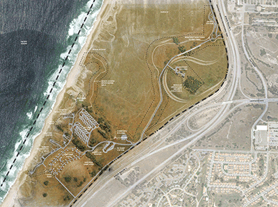
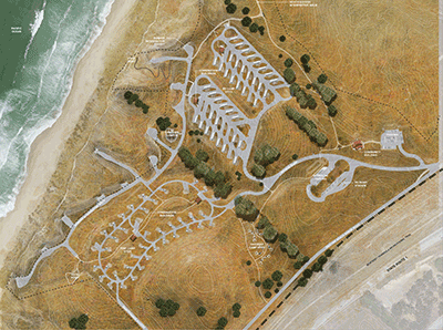
A general Plan for Fort Ord Dunes State Park was adopted in 2004 and provides for the development of the new campground and beach access facilities and identifies the area immediately adjacent to the bunkers as the location for the campground. The project site lies largely outside the Highway 1 viewshed and consists of approximately 130 acres of which 17 acres to be developed with visitor improvements.
The approximately $33 million campground project is funded by Proposition 84, the Safe Drinking Water, Water Quality and Supply, Flood Control, River and Coastal Protection Bond Act of 2006.
Construction on the Fort Ord Dunes State Park Campground began in Summer 2025 and is expected to last for 2 years. The public is advised that a portion of the recreation trail will be detoured to the parallel trail outside of the park during project construction. The remainder of the park’s trails and the beach will remain open to the public.
Current Trail Status

New Campground Features
 The new and fully compliant campground will add 98 new campsites to the California State Park system and will fill a geographical void for high demand public camping opportunities along the coast of Monterey Bay. California State Parks has designed the project in full compliance with federal and state accessibility codes. Once complete, the campground will have 4 accessible (American Disabilities Act) RV campsites, 2 accessible traditional campsites, 2 accessible traditional double family sites, 2 accessible hike/bike campsites, accessible restrooms and showers, etc. In addition, the project will include compliant parking, routes, and beach access.
The campground consists of 3 distinct camping areas:
- RV Campground Area. This area contains 45 RV campsites with electrical and water hookups and is capable of accommodating large RVs.
- Traditional Camping Area: This areas is comprised of 43 traditional tent campsites.
- A Hike/Bike/Walk-In Camping Area: This area has 10 walk-in or bike-in style campsites, each accessible from the Monterey Bay Sanctuary Scenic Trail and a designated parking area within the campground.
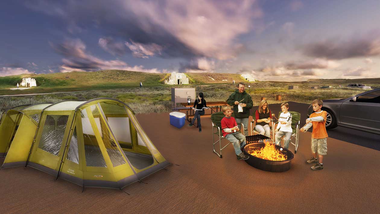 Typical traditional campsite in the new campground loop in the area of Bunker 4
The campground will also feature:
- Consistent architectural design themes for all buildings and landscape structures
- Paved parking spurs, picnic tables, fire rings and tent pads
- 3 mini-group campsites. These are single campsites where 2 campsites can be combined and shared by multiple visitor groups or extended families. These will be available for reservation for park visitors under California State Parks’ reservation system
- 3 restrooms buildings with showers (2 in the tent camping area and 1 in the RV camping area)
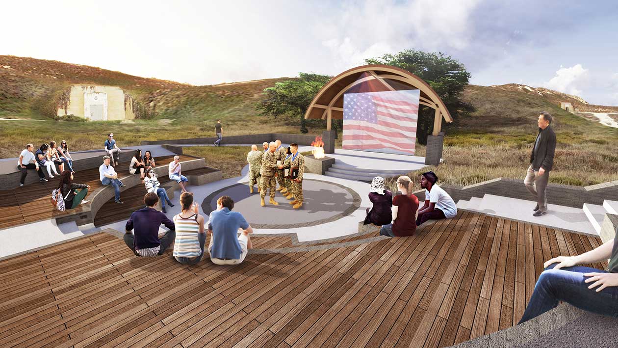
- A modern campfire center/amphitheater with a traditional fire ring and full audio visual facilities
- A sewage dump station for RVs
- Two camp host sites
- Exterior rinse stations at each restroom shower building
- The campground will be Wi-Fi ready
- Overflow parking area for extra vehicles
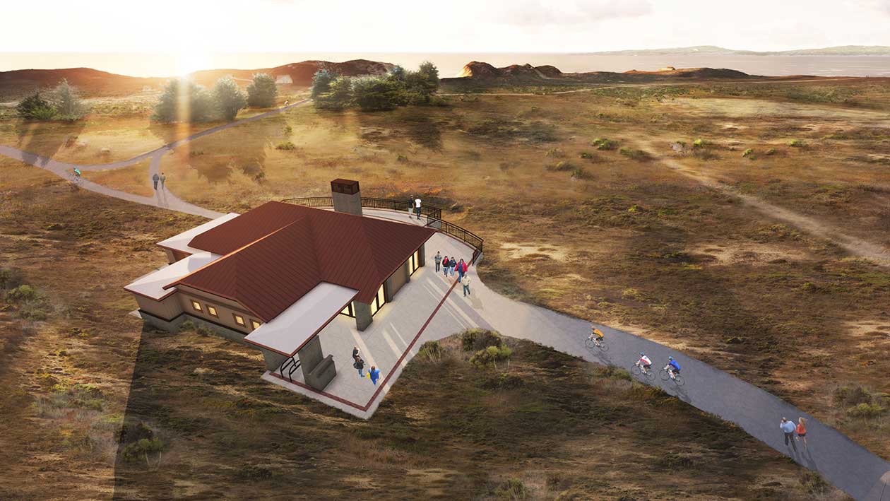
Monterey Bay Sanctuary Trail
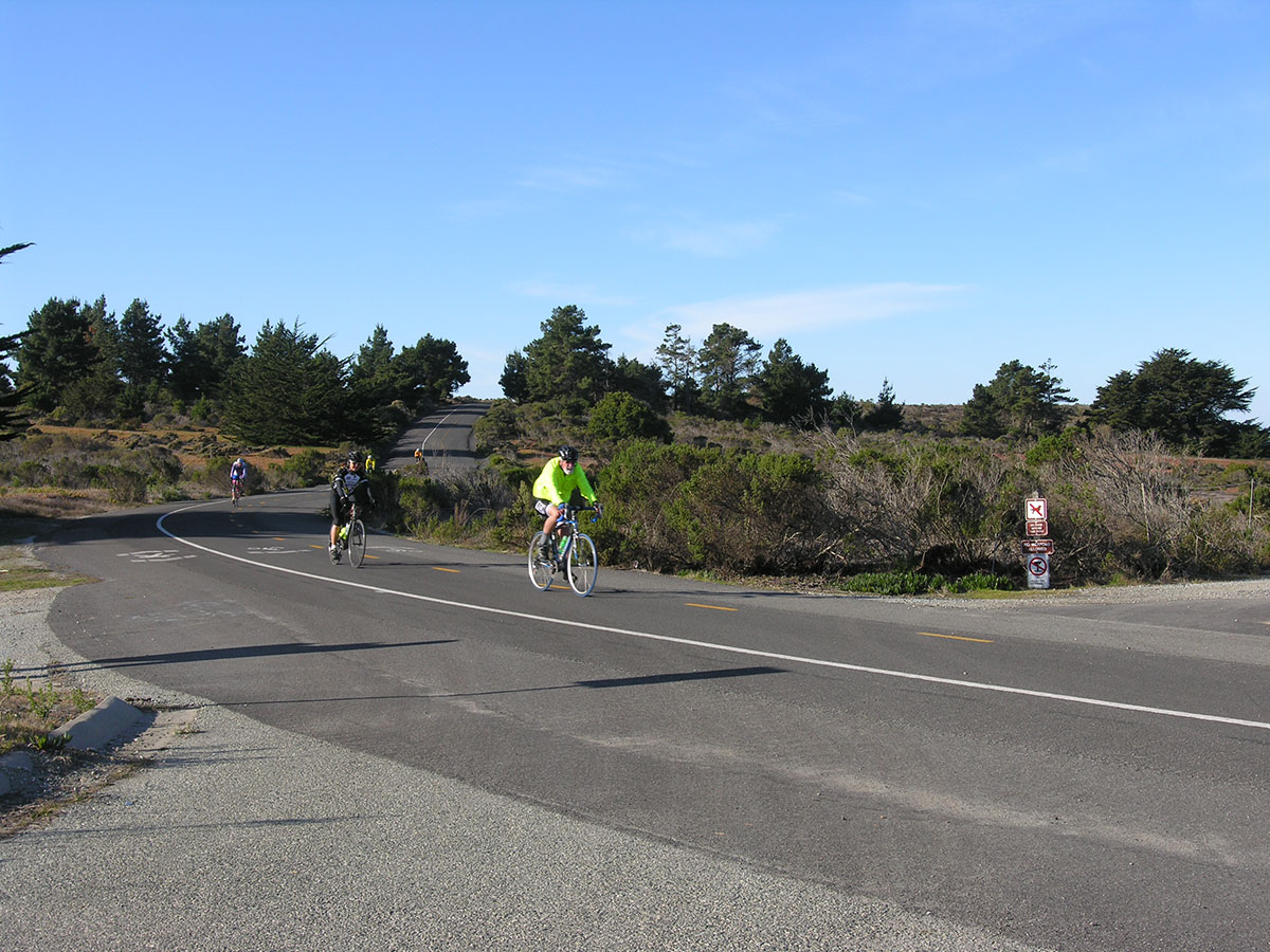 The Monterey Bay Sanctuary Scenic Trail is designated as a Class I Bike path and the plans for the campground are consistent with the Monterey Bay Sanctuary Scenic Trail Network Final Master Plan
Maintaining the Monterey Bay Sanctuary Scenic Trail's Class I bikeway designation is a key element of the project. To reduce conflict and maintain the quality of the bike and pedestrian experience, the trail is separated throughout the project from the road, and designates separate bike and pedestrian movement lanes. The public is advised that a portion of the recreation trail will be detoured to the parallel trail outside of the park during the Fort Ord Dunes Campground project construction. The remainder of the park’s trails and the beach will remain open to the public.
- The trail parallels the existing road alignment throughout most of the project and diverges from the road corridor to meet accessibility requirements where appropriate.
- The trail connects to 10 hike/bike sites for easy access.
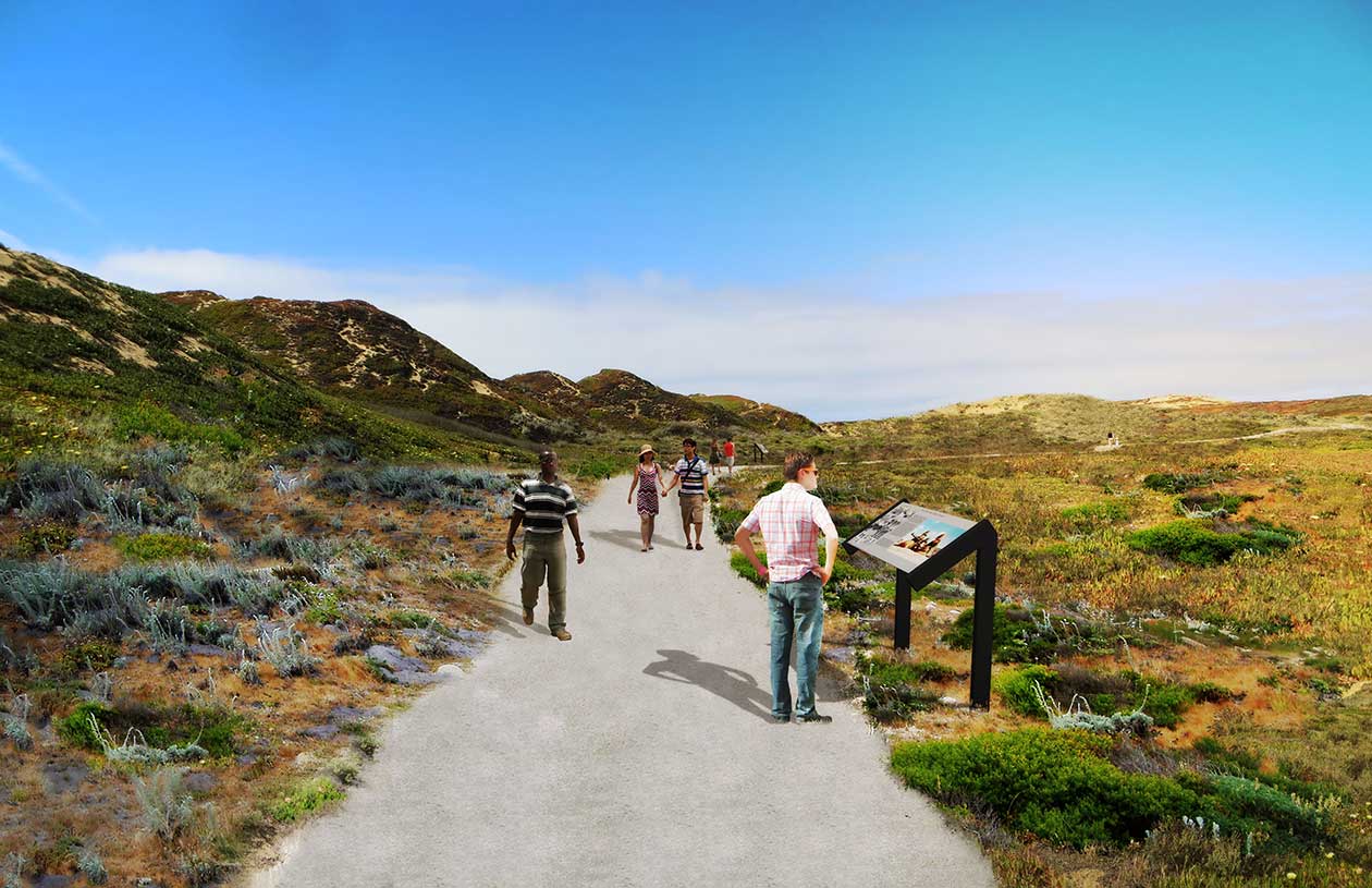
- Interpretive displays are incorporated along the trail to identify important natural and cultural resources.
- Road crossings, when they occur are clearly marked, signed and identified on the trail to allow safe crossing.
Beach Access
Campground visitors will be able to access the beach via an interpretive walk and beach access walkway, located north of the new campground. The structure will provide year-round accessible access from the bluff and allow visitors to reach the beach without damaging the sensitive dunes.
 Access ramp at main beach access point to the north of the new campground.
Overlooks
The campground will feature a new overlook with a fantastic 360 degree panoramic view of the ocean, old Fort Ord, Monterey Bay and the cities of Monterey, Seaside, Marina and Sand City. The overlook is located in the heart of the campground, at the crest of the dunes, overlooking the ocean.
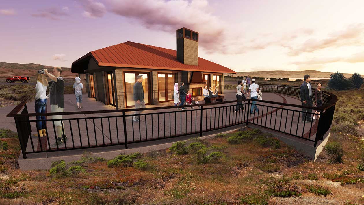
Community Building / Visitor Center
A community building/visitor center provides an area for gathering informally, getting out of the weather and learning about the site and its resources.
 The new community building will feature an outdoor gathering area for park visitors.
The building features:
- An indoor/outdoor fireplace for visitor warming
- A small kitchen to accommodate concession food services or special events on a reservation basis
- Two restrooms
- Office space and storage
- Interpretive/education areas with seating and tables
- Outdoor ocean overlook area
- Approximately 40 car parking area
- The building is connected to the campground, interpretive trails and beach access as part of the campground’s interior pedestrian trail system and is readably accessible from the Monterey Bay Sanctuary Scenic Trail
Interpretive Facilities
The campground project is rich in interpretive facilities, including the former military base's 12 existing storage bunkers located adjacent to the new campground.
- An interpretive walk along the front of the bunkers with information related to the park's military history
- An extensive wayfinding mapping system to aid and educate visitors
- An interpretive walk from the campground to the beach
- Multiple interpretive nodes throughout the campground and on the interpretive walk, each containing historical, cultural, natural and resource protection information, including Indigenous Tribal ancestral lands, and the African-American history of Fort Ord
- Improved indoor and outdoor spaces such as a campfire center/amphitheater and community building/visitor center with audio visual programs and exhibits
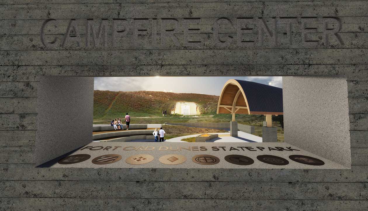 The project will feature a modern campfire center designed for traditional parks campfire center programs and for interpretive gatherings.
Natural Resource Sensitive Design & Restoration
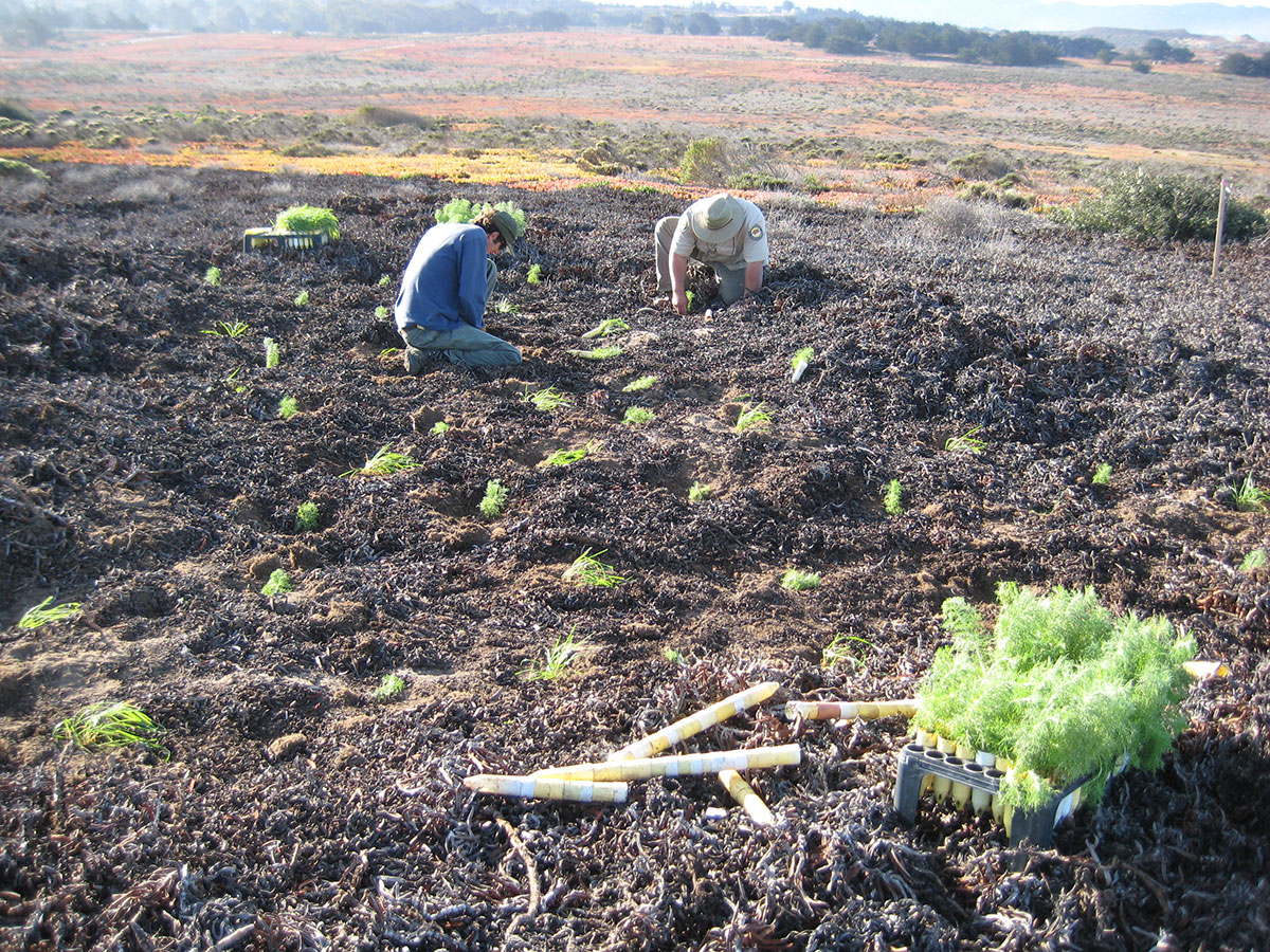 State Parks staff and volunteers from a variety of program areas are recruited for restoration work at Ft Ord Dunes
The campground was sited to minimize visibility from Highway 1 and impacts to natural resources. Sensitive design and restoration elements include:
- Sited largely outside the Highway 1 viewshed
- Compact design limited direct impacts to sensitive species
- Includes a 200' wildlife corridor for habitat connectivity
- Restores dune landforms
- Removes non-native vegetation (i.e., ice plant)
- Restores native dune habitat
- Critter proof trash enclosures will be incorporated
Natural Resource Facilities
Several facilities are incorporated to preserve and protect the natural resources of the park.
These include:
- Interpretive panels educating park visitors on resource sensitivity
- Visitor control signage for resource protection
- Resource protection fencing as required by the park’s Habitat Conservation Plan
- An extensive and ongoing dune vegetation restoration program
- The beach access helps stabilize the dunes by reducing dune erosion
 The new community building is sited and orientated to take advantage of the spectacular view of the Monterey Bay.
Pedestrian Circulation System
 An accessible trail system throughout the campground will provide opportunities for visitor education and interpretation of the natural and cultural resources present throughout Ft Ord Dunes
Facilities within the new campground will be connected by a fully accessible pathway system connecting camping areas with the community building, campfire center, bunkers, overlooks, beach access and the Monterey Bay Sanctuary Scenic Trail.
Improved Park Operations Facilities
To facilitate park management, maintenance and visitor information/orientation, several new facilities are included.
- A new park entry sign
- A new entrance station building at the campground entrance
- A maintenance building and staging area
- Miscellaneous fencing, gates, landscaping, hardscape, signage, and site furnishings as required
- The lighting in the two entrance tunnels under the highway, at the main park entry, will be restored
 A new park entry sign will anchor the park’s entrance experience and help direct traffic through the improved park interior road system.
Utilities and Technology
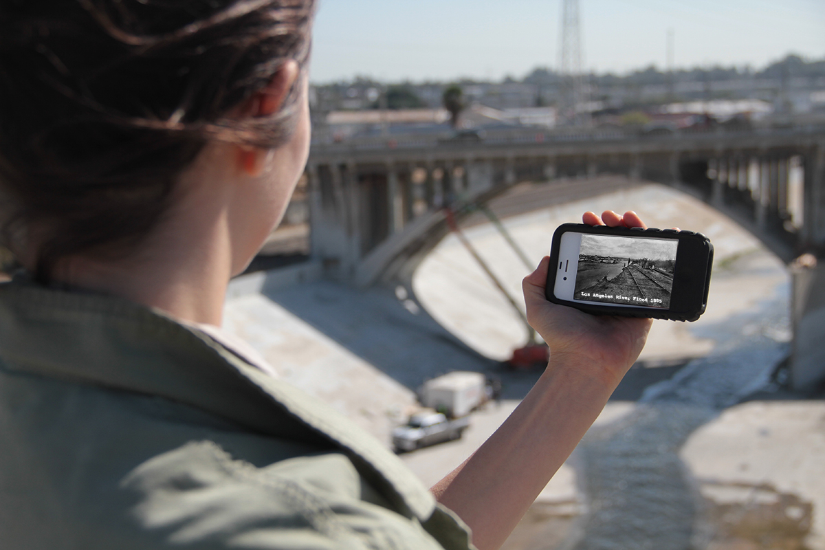 Shown above is the mobile app used to aid in interpretation at Los Angeles State Historic Park
Fort Ord Dunes State Park has no existing utility infrastructure to serve park visitors. Through partnerships with PG&E, the Marina Coast Water District, City of Seaside, City of Marina, Transportation Agency for Monterey County (TAMC), AT&T and others, the project includes new domestic water connections, electrical infrastructure, connection to regional sewer system, telephone and internet connections, and Wi-Fi ready features to service the park and its visitors.
The new campground will have state of the art facilities to help interpretive the park's rich natural and cultural resources, and distinctive history as the former Fort Ord Army Base. Interpretive apps, mobile walking tours, a modern campfire center, and much more, are in the future for this very unique State park.
Illustrative Plans
1 - Campground Plan
2 - Entry Station Plan

1 - Site Plan