
California State Parks to Temporarily Close Main Trails to Popular Burney Falls for 2024 Season
Contact:
Aaron Wright
Public Safety Chief
Northern Buttes District
(530) 370-8180
BURNEY, Calif.— California State Parks today announced the temporary closure of the main trails that provide access to the highly-visited falls at McArthur-Burney Falls Memorial State Park. The $835,000 project and trail closures are estimated to begin on April 1, pending weather conditions, and will remain in place for the duration of the 2024 summer season and most likely the fall season. The closure is to address critical repairs and improvements to the trails and natural slopes that have been impacted by high visitation and substantial use of these sensitive areas for foot access to the pool.
What’s closed?
- Falls Loop Trail
- Burney Creek Trail
- Visitors will have no access to the waterfall or fall’s pool area with limited views from the viewing area at the top of the falls.
What’s open?
- The remainder of the park will be open for visitors including the Rim and Pioneer campgrounds, Burney Falls General Store, Marina, Visitor Center, and day-use areas.
- The Rim Trail, PSEA Trail, Headwaters Trail and Pioneer Cemetery Trail will remain open for visitors.
- The Fisherman’s Bridge will remain open to provide access to and from park via the Pacific Crest Trail, Headwaters Trail Loop, and Headwaters Equestrian Camp only from the Falls Overlook.
Additionally, if planning a trip to the area, please be aware that Caltrans will be performing a major Highway 89 rehabilitation project during the same period which will significantly add traffic congestion, delays, and intermittent traffic closures near the park entrance.
State Parks thanks the public for their patience and understanding as it works to improve the park’s trails and access to Burney Falls. The McArthur Burney Falls Memorial State Parks website will be updated with the latest information as it becomes available.
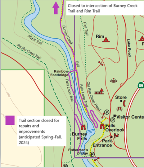
Map showing trail closures at McArthur-Burney Falls Memorial State Park.
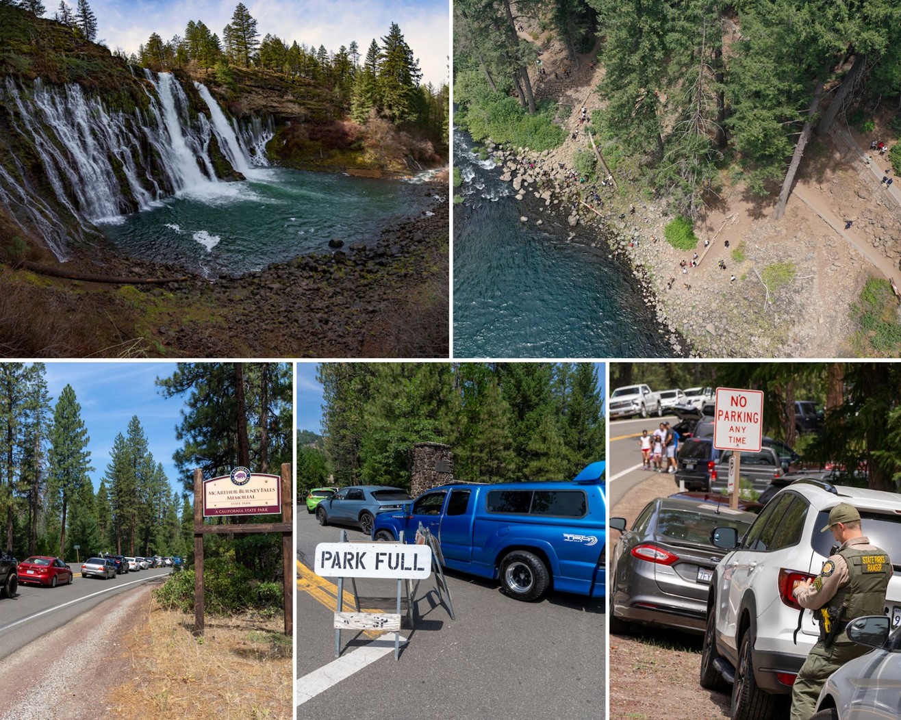
Top left: View of the falls at McArthur-Burney Falls Memorial State Park. Top right: Aerial shot of the damaged trails and erosion near the falls. Bottom photos: Traffic along Hwy 89 and illegally parked cars receiving citations. Photos from California State Parks.
Subscribe to California State Parks News via e-mail at NewsRoom@parks.ca.gov
California State Parks provides for the health, inspiration and education of the people of California by helping to preserve the state’s extraordinary biological diversity, protecting its most valued natural and cultural resources, and creating opportunities for high quality outdoor recreation.