
Salt Point State Park includes six miles of the Sonoma Coast, ranging from sandy beach coves to steep bluffs and sandstone cliffs. At the top of the coastal ridge there is a large prairie and pygmy forest. Wildlife includes the long-tailed weasel, wild pigs, brown pelicans and other water birds, blacktail deer, raccoons, coyotes, and a variety of rodents. The park has miles of hiking and horseback trails. The area is also the site of an underwater reserve for divers.
- Distance: 15.34 Miles.
- Reservation Availibility: Yes
-
Camping Types:
Group Tent Campsite
Campsite
Hook Up (E/W/S) Campsite
- Make your reservation at ReserveCalifornia.com

Sugarloaf Ridge State Park is where the headwaters of the Sonoma Creek run through gorge and canyon, across the meadow floor beneath scenic rock outcroppings.
With 2,700 acres, the park has 25 miles of trails for hiking, horseback riding and bicycle use.
There is also a self-guided nature trail along Sonoma Creek that starts near the campground.
Deer, bobcats and gray foxes can be seen in the park. From the 2,729-foot summit of Bald Mountain on a clear day visitors can see views of the Sierra Nevada and the golden gate bridge.
The park also houses the Robert Ferguson Observatory http://rfo.org that can be rented, along with the Group Campground, for private parties.
A Group Picnic area and an Amphitheater are available for private use with a reservation.
- Distance: 32.22 Miles.
- Reservation Availibility: Yes
-
Camping Types:
Campsite
Group Day Use
Premium Campsite
- Make your reservation at ReserveCalifornia.com

In the heart of Napa Valley, Bothe-Napa Valley State Park is a 1900 acre park offering year-round camping, picnicking, hiking and swimming (weekends in the summer). Visitors can follow hiking trails along Ritchie Creek, walk among Redwood tree groves, or climb to a beautiful vantage point on Coyote Peak. A 30-minute hike along the History Trail leads to nearby Bale Grist Mill State Historic Park, open weekends for tours.
- Distance: 32.69 Miles.
- Reservation Availibility: Yes
-
Camping Types:
Group Tent Campsite
Yurt (6 ppl)
Yurt (4 ppl)
Tent Campsite
Campsite
Cabin (2 People)
Cabin (4 People)
- Make your reservation at ReserveCalifornia.com
Samuel P. Taylor State Park offers campgrounds and picnic areas for small or larger groups. Hiking trails take visitors through the shady woods or the sunny slopes of Mount Barnabe. The partially paved Cross Marin Trail is a favorite among bicyclists and families out for a stroll along Lagunitas Creek. Dating back to the 1800's, historic Camp Taylor is comprised of the Azalea and Redwood Grove picnic areas as well as the Creekside and Orchard Hill loops of campsites; Irving picnic area is also nearby. The Madrone Group Camp hosts a large group campsite as well as newly installed cabins which can be reserved. The primitive Devil's Gulch area is comprised of a group horse camp and two small group sites just above Devil's Gulch Creek.
- Distance: 35.13 Miles.
- Reservation Availibility: Yes
-
Camping Types:
Tent Campsite
Hike/Bike Campsite
Campsite
Equestrian Group Campsite
Group Tent Campsite
Group Campsite
Group Day Use
Group Dailyuse (A)
- Make your reservation at ReserveCalifornia.com

Clear Lake State Park is on the shores of California's second largest freshwater lake. The area is popular for all kinds of water recreation, including swimming, fishing, boating and water-skiing. Anglers can catch large mouth bass, crappie, bluegill and channel catfish. The park is the nesting place for waterfowl. Hikers enjoy the Indian Nature Trail, a self-guided trail that shows how the Pomo people lived in the area for centuries, utilized the area's resources. The trail passes through the site of what was once a Pomo village. The park visitor center features displays about the area's natural and cultural history.
- Distance: 43.16 Miles.
- Reservation Availibility: Yes
-
Camping Types:
Campsite
Premium Campsite
Tent Campsite
Group Campsite
- Make your reservation at ReserveCalifornia.com
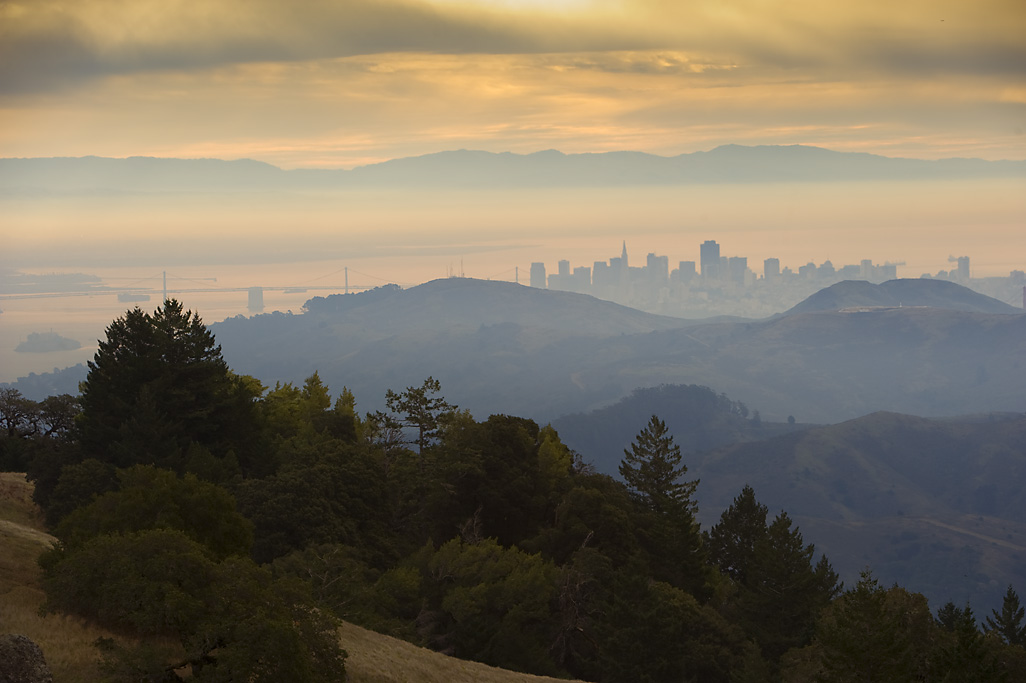
Just north of San Francisco's Golden Gate is Mount Tamalpais, 6,300 acres of redwood groves and oak woodlands with a spectacular view from the 2,571-foot peak. On a clear day, visitors can see the Farallon Islands 25 miles out to sea, the Marin County Hills, San Francisco and the Bay, hills and cities of the East Bay, and Mount Diablo. On rare occasions, the Sierra Nevada's snow-covered mountains can be seen 150 miles away. Coastal Miwok Indians lived in the area for thousands of years before Europeans arrived. In 1770, two explorers named the mountain La Sierra de Nuestro Padre de San Francisco, which was later changed to the Miwok word Tamalpais. With the Gold Rush of 1849, San Francisco grew; and more people began to use Mount Tamalpais for recreation. Trails were developed, and a wagon road was built. Later, a railway was completed and became known as the Crookedest Railroad in the World It was abandoned in 1930 after a wildfire damaged the line.
- Distance: 45.16 Miles.
- Reservation Availibility: Yes
-
Camping Types:
Group Primitive Campsite
Group Tent Primitive Campsite
Equestrian Group Tent Campsite
Hike In Primitive Campsite
Cabin (5 People)
- Make your reservation at ReserveCalifornia.com

Once the site of a thriving fishing village on San Pablo Bay, China Camp State Park is not only the historic remains of the village, but also 1,640 acres of natural watershed along the shores of San Francisco Bay. The park features extensive inter-tidal, salt marsh, meadow and oak habitats that are home to a variety of wildlife, including deer, squirrels and numerous birds. Visitors not only enjoy wildlife-watching, but also hiking, swimming, boating and windsurfing. The park has some of the best weather in the San Francisco Bay Area, with an average of more than 200 fog-free days per year.
- Distance: 45.98 Miles.
- Reservation Availibility: Yes
-
Camping Types:
Group Day Use
Campsite
Group Primitive Campsite
- Make your reservation at ReserveCalifornia.com

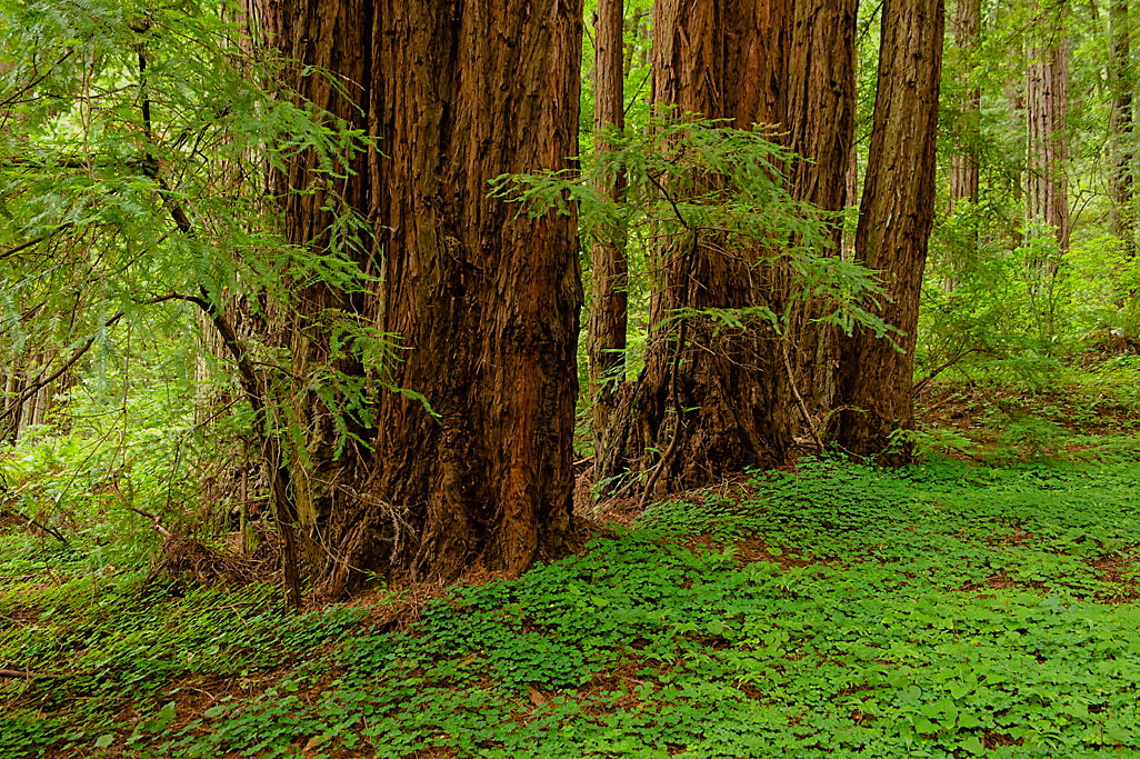
Hendy Woods State Park features two virgin redwood groves- Big Hendy (80 acres, with a self-guided discovery trail) and Little Hendy (20 acres). The Navarro River runs the length of the park. Located in the middle of the Anderson Valley wine district, the 850-acre park is warmer and less foggy than redwood parks along the coast. The park is well known for a fallen redwood stump that was home for a man known locally as the Hendy Woods Hermit. In the summer, swimming is popular, as is kayaking and canoeing in late winter and early spring. A wheelchair accessible nature trail leads into the heart of Big Hendy Grove. The park also features interpretive exhibits, Junior Ranger nature walks, and campfire programs.
- Distance: 49.56 Miles.
- Reservation Availibility: Yes
-
Camping Types:
Campsite
Hook Up (E ) Campsite
Hike/Bike Campsite
Cabin (6 People)
- Make your reservation at ReserveCalifornia.com
